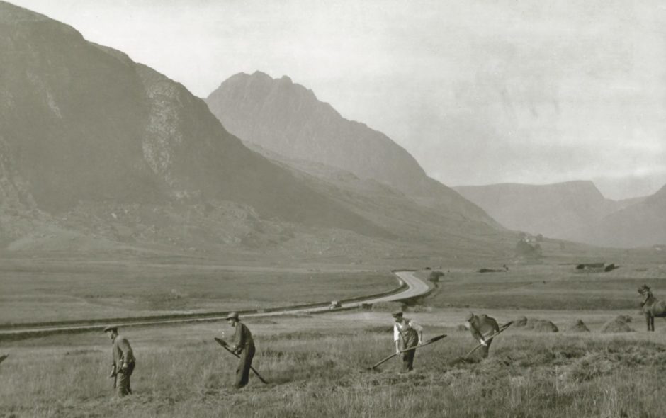
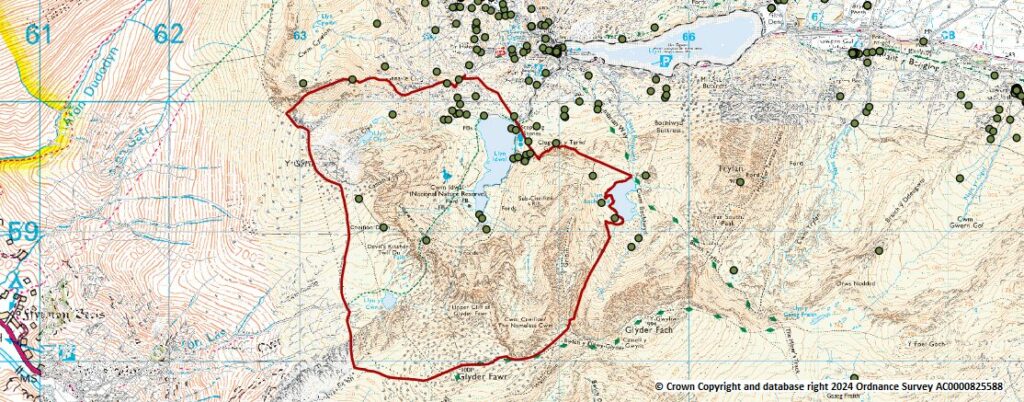
The impacts that people have had on the landscape of Cwm Idwal and the surrounding area are quite apparent. But there is more to discover about our ancestors’ history under the surface. People have been living and influencing the mountains of Snowdonia for thousands of years, and the map below show how many archaeological sites are scattered across the Glyderau and Cwm Idwal. As the ice receded following the ice age, people moved into the area. It’s likely that the first migrants to Snowdonia were nomadic tribes, moving from one area to the next to hunt. It’s thought that these early people had a significant effect on the landscape. The pollen records from this time show a notable amount of heather in the landscape. The persistence of heather for a prolonged period of time requires human intervention, which suggests that humans were burning the land at this time, and that the landscape was a patchwork of woodland and open ground, as opposed to a dense continuous cover of forest.
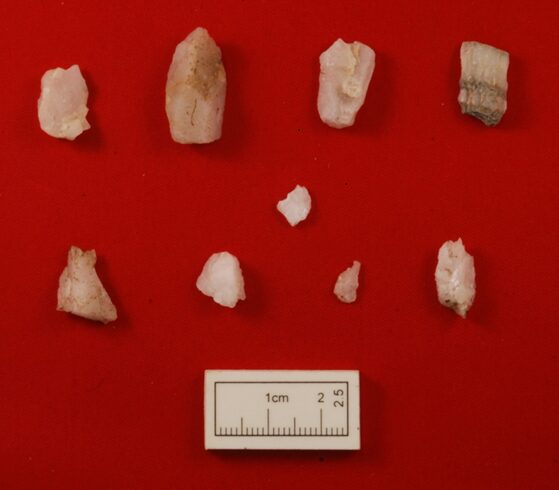
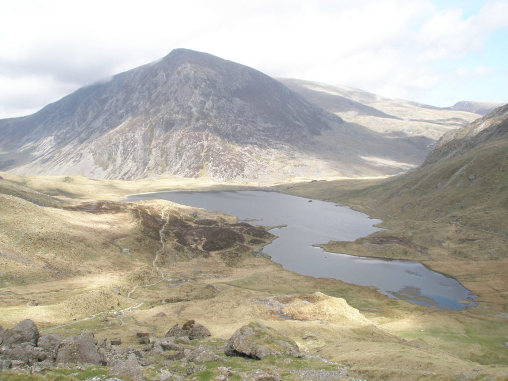
Following a recent study in Cwm Idwal, small pieces of quartz were found by a ruin of a Hafoty, near Clogwyn Y Tarw, and on the beach that lies on the Northern shore of Llyn Idwal. By studying these pieces of quartz under a microscope lens, the archaeologists could see that the pieces had been deliberately honed. These pieces can be dated back to the late Mesolithic period (6000 years ago). These are the earliest traces we have of human presence in Cwm Idwal.
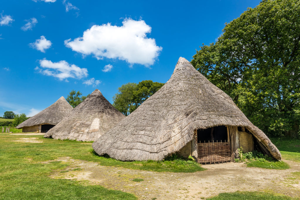
The remains of round huts are further evidence that people settled here in Cwm Idwal. Locations of many roundhouses can be seen on the previous map of archaeological sites. During the bronze age and iron age, there were great changes in the way people farmed. Instead of travelling around with their animals, people were enclosing plots of land and establishing simple fields for grazing. Any change in land use would affect the landscape including the distribution of plants and animals. It was also the practices of these people to build cairns on the summits of mountains that give us the name of the nearby mountain range Y Carneddau (“the cairns”). Below is a timeline showing the different ages that People inhabited Cwm Idwal.
This picture makes it clear that deforestation in the area started a long time ago, and that agricultural practices since than have limited the opportunities for trees to dominate the landscape. Trees such as rowan and holly grow in the remotest parts of Cwm Idwal, such as the steep cliffs of Y Twll Du (Devil’s Kitchen) and if the experiment to shepherd grazing animals away from Cwm Idwal continues, perhaps we will see trees re-establishing here in the future.
Place names
We can learn a great deal of the lives of our forbears by studying archeological sites, butthe place names we have in Cwm Idwal and Nant Ffrancon can also tell us plenty about our history. One element that becomes obvious in the landscape is the reference to keeping cattle, or oxen. In Cwm Idwal itself there is Clogwyn y Tarw (Cliff of the Bull), and lower down the Nant Ffrancon valley is Cwm Bual (The Cwm of the Ox). The word Bual (Oxen) in Welsh contains the the same element – ‘Bu’ as the Welsh word for shepherd – Bugail. Despite nowadays shepherd, and bugail, are synonymous with sheep, a reflection on this word reveals that it was cattle that the original shepherds primarily tended to in Wales. The regularity of the references to cattle in the place names in Eryri highlight that cattle, for a long time, was the prized livestock in the area.
Other place names also help us understand our landscape and what tipe of habitat used to be here. These names can be used as a record of what lived and grew here long before scientific records were being kept. The main path from Cwm Idwal to Y Glyder Fawr climbs through Y Trigyfylchau (the cliffs either side of Y Twll Du – “Devil’s Kitchen“) towards Llyn y Cwn. This path is called Llwybr y Carw (“the deer path“). There is also an area of land on the northern banks of Llyn Ogwen named Perth yr Ewig (“scrubland of the doe”). There is no history of deer in the Cwm Idwal and Ogwen area for centuries – but the place names are an echo of a long forgotten past. Similarly we can look at the placenames along Afon Ogwen, here we’ll come across places such as Sarn yr Afanc (“beaver’s causeway“), or even the valley name itself Nant Ffrancon (Nant yr afancon – “the valley of beavers“), suggesting that beavers were once found in the valley.
More recently on early maps commissioned by the Penrhyn Estate we can see other place names recorded. Coed Cerrig y Fran (“the woods of the crow rocks”) is the name of an area of land written as “The Mushroom Garden” on modern OS maps, a treeless area, but the old name suggest that this wasn’t always the case. We see also names of fields in these early estate maps, such as “cae lloiau” just under Craig y Foty (“Milestone Buttress“), again recalling the old way of keeping cattle on the slopes of Eryri.
It is not just names, but legends too that tell of the rich history to this landscape. The names and legends enrich out understanding f the landscape and connect us to the land.
Climbing
There is a rich history to climbing and mountaineering in the Cwm Idwal and Ogwen area. The first to mention their adventures to the summits and crags were botanists. The earliest record is attributed to Thomas Johnson, an apothecary from London in 1639. Later the renowned Welsh botanist, Edward Llwyd, wrote of his journey to the area in 1682. Llwyd recoded many new plants across Eryri, including the iconic Snowdon Lily (Gagaea serotina). The recorded journeys of these early botanista are very important to our understanding of the area’s past, however they would have been impossible without the knowledge and assistance of local guides. The interesting history of the local guides and their employers can be read in “Tywysyddion Eryri” by Dewi Jones.
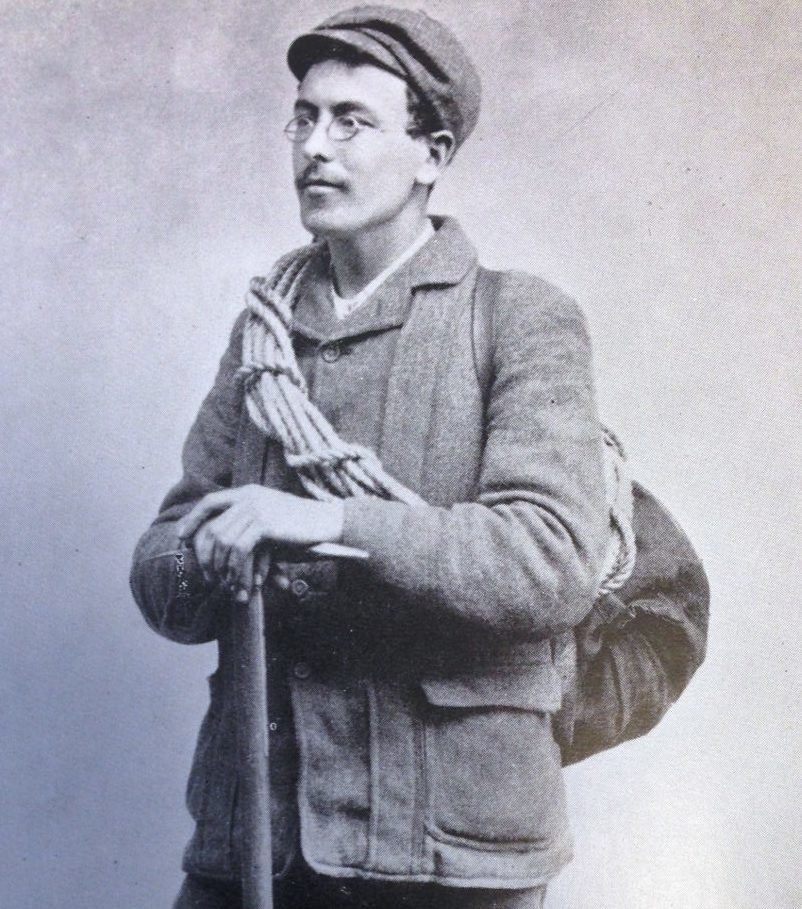
One of the most famous rock climbers locally, and nationally at the end of the 19th century was Owen Glynne Jones. O.G.Jones was a very talanted rock climber, not only did he invent the modern way of grading climbs according to the challange facing the climber, he is also recognised as the first to climb the more popular climbs on Craig Idwal and on Tryfan in the modern method using ropes.
Cwm Idwal and Tryfan have played an important part in the history of mountaineering and its development through the 20th century. In fact it has a role in perhaps the zenith of the sport. The cliffs of Y Rhiwiau Caws (“Idwal Slabs“) and those on Tryfan were the base for Edmund Hillary and his team to practice their climbing techniques before their successful expedition to the summit of Everest in 1953.